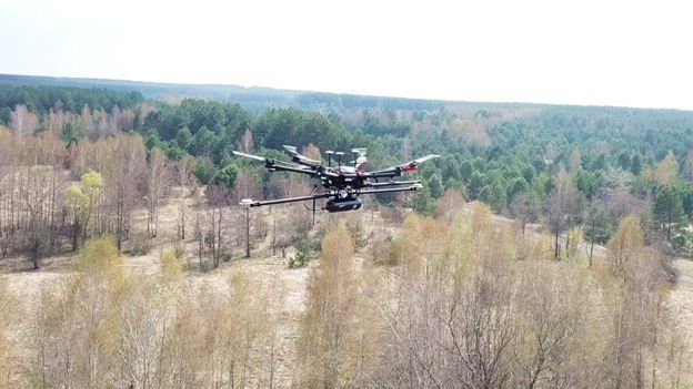
The UK’s National Centre for Nuclear Robotics (NCNR) has developed a drone-mapping system that allows scientists to investigate hazardous places from a safe distance. Scientists plan to create a map of radiation distribution in the Red Forest in the Chernobyl Exclusion Zone, the BBC informs.
In April of this year, British scientists investigated the Red Forest in the Chernobyl Exclusion Zone [about 202 km2 of trees adjacent to the Chernobyl Nuclear Power Plant, which assumed the largest share of radioactive dust emissions during a reactor explosion in 1986 – ed.] using a suite of drones to create a common radiation propagation map.
The results of the study confirmed the current understanding of the radiation distribution in the forest, but in far greater detail than has previously been available, and a few unexpected hotspots identified (places with a high concentration of radioactive substances). This data is useful for updating protocols used to ensure the security of visitors to the zone.
According to Professor Tom Scott from the Bristol University and the co-director of NCNR, one of these plots is redeposited soil that has been heavily contaminated with radioactive waste. According to the scientist, thus wanted to reduce the amount of waste.
“The legacy left at that facility was giving a very high radiation dose – about 1.2 millisieverts an hour. That would mean I’d be able to hit my yearly dose within just a few hours,” said the professor.
A team of British researchers is planning to return in the next few months to explore the rest of the Chernobyl Exclusion Zone.
As The Journalist reported, Chernobyl Reserve representatives together with the police will begin to patrol Exclusion Zone territory.
Подписывайтесь на telegram-канал journalist.today

